Mark Slavonia | December 20, 2022
The Very High Frequency Omnidirectional Range Edition
On navigation, beacons, and pre-GPS
Mark Slavonia (MJS) is an investor, a pilot, and an avid cyclist. He wrote about radio altimeters, rowing machines, traveler’s checks, and more. He posts other things that are interesting on his website.
Mark here. In 2016 the U.S. Federal Aviation Administration announced plans to phase out redundant stations in the network of 1,000 radio beacons used by pilots to navigate the skies prior to the advent of GPS. The FAA plans to maintain a “Minimum Operational Network” of these beacons as a backup in the event of GPS outages and as a service to aviators who fly planes without GPS receivers.
The stations are called VORs (which stands awkwardly for Very High Frequency Omnidirectional Range). They’re white cones, about 20 feet high, placed at intervals of about 50-100 miles across the United States. Because VOR signals travel best at line of sight, they are often found on hilltops or in open fields. Sometimes they’re located at an airport.
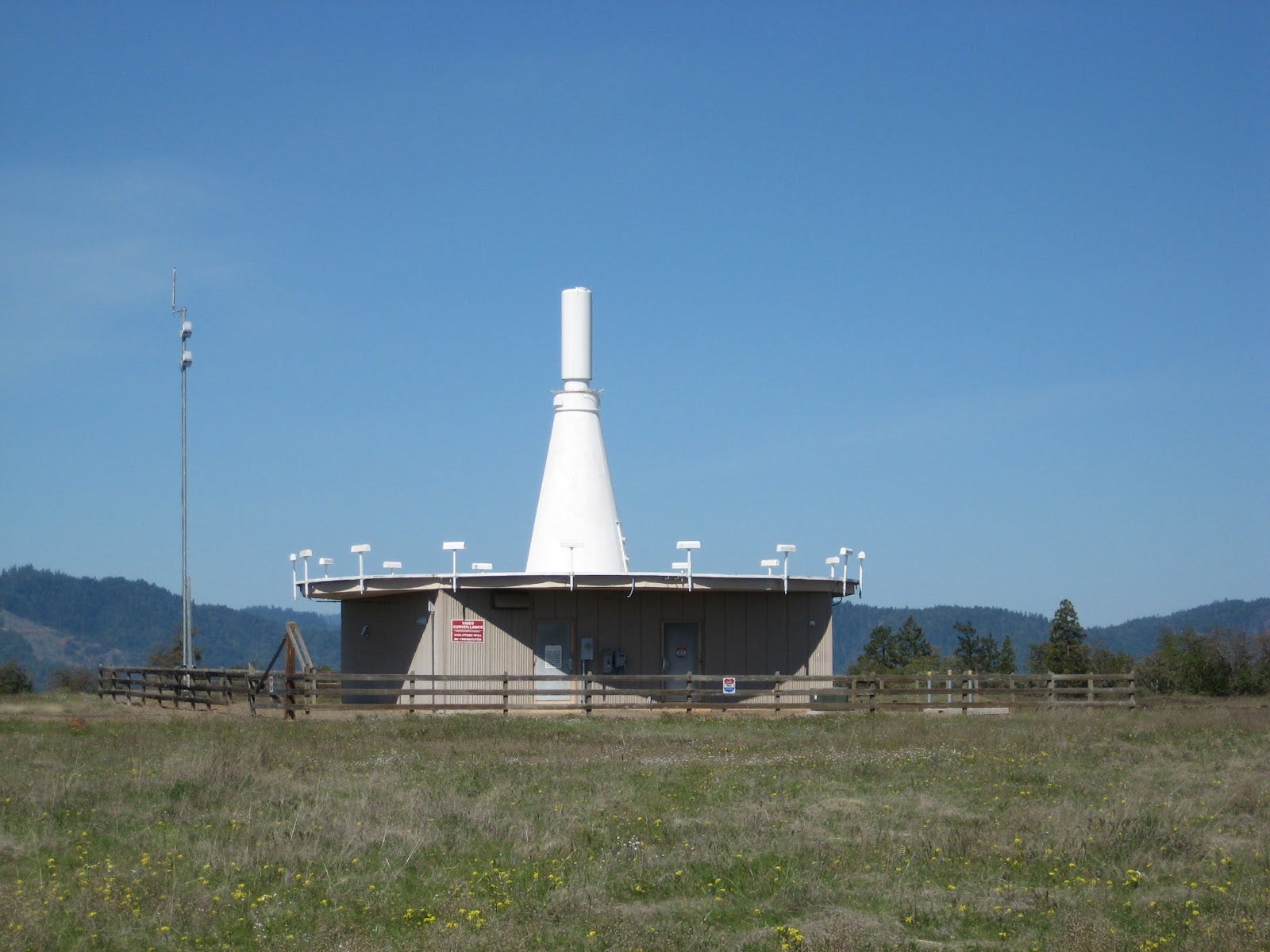
The Rogue Valley VOR in Oregon
Why is this interesting?
Before the Global Positioning System was released for civilian use in the 1980s, airplanes in the continental U.S. relied on VORs to navigate the skies. Each VOR is essentially a small radio station, broadcasting on an assigned frequency just above the FM dial on your car’s radio. If you dial 107.9 FM on your radio here in Northern California, you’ll get Santa Rosa’s Oldies 107.9, but if you could just keep tuning a little bit higher at 108.4 MHz, you’d reach the Redding VOR. You’d hear a static-like signal that can be decoded by the plane’s equipment to point to the VOR station, and you’d also hear a Morse Code signal “RDD” (.-. -.. -..) audible to pilots, who use the morse code signal to confirm that they’re receiving the correct VOR station.
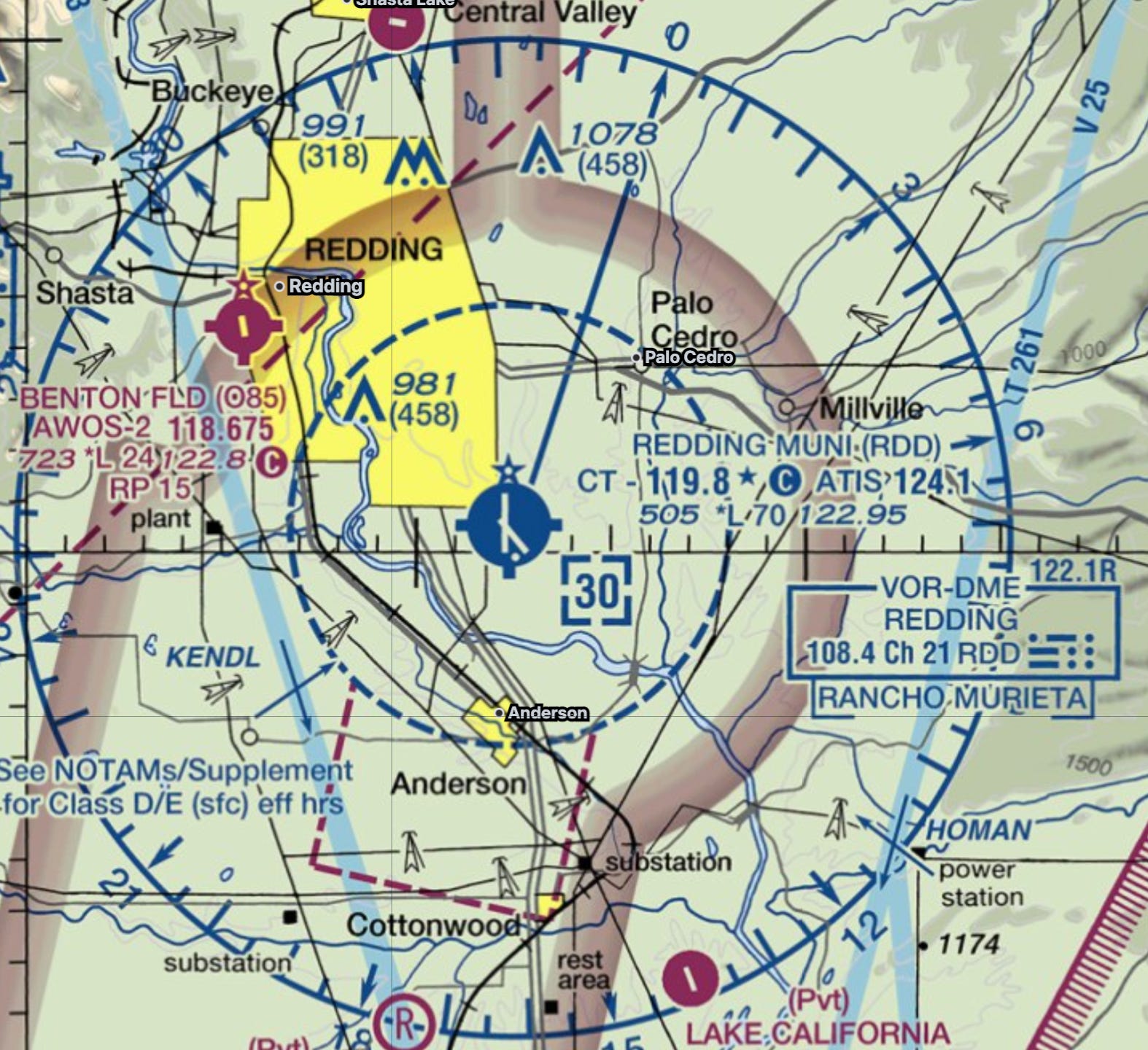
The Redding, California VOR as shown on the standard aviation chart
There are VOR stations hiding in plain sight everywhere. New Yorkers are covered by the Canarsie VOR near JFK airport, and by VORs in Colts Neck, NJ, Solberg, NJ, Sparta, NJ, and Bridgeport, CT. The Google Maps satellite image of the Canarsie VOR even captured a plane passing over the beacon as part of its composite image.
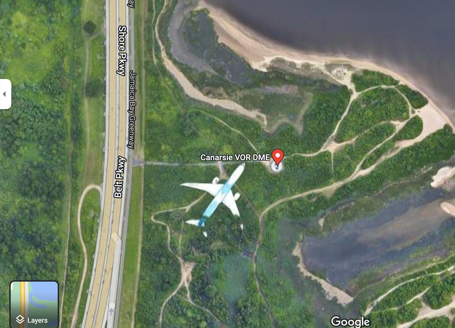
Google Maps satellite image of the Canarsie NY VOR
In good weather, pilots use these beacons to confirm their locations. A pilot who became lost or disoriented could determine the plane’s location by finding the direction to any two VOR stations and triangulating. In poor weather, these beacons formed a network that air traffic control used to guide planes when flying by visual references was impossible or unsafe.
VOR beacons are connected by direct routes called Victor airways. (“Victor” being the aviation alphabet designation for the letter “v” from the word “very” in “VOR,” so in a way, these are Victor airways in place of being called Very airways.) Before GPS, pilots would navigate in poor weather by flying from VOR to VOR along these Victor airways, as directed by air traffic control. A pilot taking off from Chicago’s Midway airport might get directed to fly south to the Roberts VOR (broadcasting on 116.8 MHz), then to fly southwest along the Victor airway V191 to the Adders VOR on 117.2 MHz, and then to the Troy VOR on 116.0 MHz, from which the pilot could pick up radio guidance for an approach to the airport.
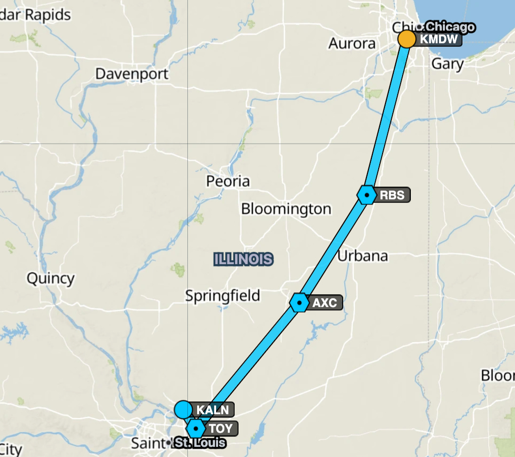
A route between VORs from Chicago to St. Louis
Now that GPS is ubiquitous in commercial planes and common in smaller planes, air traffic control is more likely to route traffic directly to its intended location, but the air traffic control system still uses the Victor airways network and the nodes formed by VORs as convenient reference points or alternative routings to provide for more space and safety for air traffic. Pilots still use VORs to report their position to ATC. A pilot might announce they are “five miles south of the Woodside VOR” when making initial contact, for example.
The Minimum Operational Network of VORs will eliminate approximately one-third of VORs in the continental United States, leaving over 600 beacons in operation to guide pilots when needed. Phasing out 300 radio beacons over ten years might not seem like a huge difference, but it shifts the air traffic system from one that was built on VOR navigation where GPS was a convenient overlay to one where GPS is the primary technology and VOR navigation is used as a backup system in case of emergency. (MJS)

WITI Classifieds:
We are experimenting with running some weekly classifieds in WITI. If you’re interested in running an ad, you can purchase one through this form. If you buy this week, we’ll throw an extra week in for free on any ad. If you have any questions, don’t hesitate to drop a line.
Why is your family interesting? With Storyworth, record their stories one weekly email at a time, and gift them a beautiful printed book. Get $10 off Storyworth.
Exhibit B. Books: true crime told and sold Shop the 12 Days Of ExMas sale now

Quick Links:
The FAA’s surprisingly nostalgic video about the VOR Minimum Operational Network
Boldmethod article on the VOR shutdowns, with map
Wikipedia’s article on VORs goes into a lot more detail
Thanks for reading,
Noah (NRB) & Colin (CJN) & Mark (MJS)
—
Why is this interesting? is a daily email from Noah Brier & Colin Nagy (and friends!) about interesting things. If you’ve enjoyed this edition, please consider forwarding it to a friend. If you’re reading it for the first time, consider subscribing (it’s free!).