Noah Brier | March 29, 2022
The GeoGuessr Edition
On games, location, and educated guesses
Recommended Products

GeoGuessr is a geography game which takes you on a journey around the world and challenges your ability to recognize your surroundings. It drops players in a random Google Street View location without map markings, and they need to figure out where they are.
Noah here. My latest YouTube obsession is watching people streaming themselves playing the game GeoGuessr. The game mechanics are about as simple as they come: you get dropped in a random Google Street View scene, and you have to try to figure out where you are. Like Street View, you can move up and down the block, zoom in and out, and pan around 360 degrees. Unlike Street View, there are no helpful map markings to tell you where you are. When you feel like you’ve figured it out, you drop a pin on a map, and your score is calculated based on the distance between your guess and the actual location.
Competitive players, not content with being dropped on a random road somewhere in the world, add extra layers of difficulty: turning off moving, panning, zooming, and going for perfect scores (five for five within a small radius of the location).

Why is this interesting?
Watching people play the game is wonderful because they clue you in on their technique for figuring out where they are. There are obvious things to look for—like the language of signs and the side of the road they’re driving on. (URL endings on billboards are easy giveaways as well.) But also more nuanced scenery like the angle of the shadows or the vegetation (dense and tropical means closer to the equator). Pros find all sorts of tricks, like the wording and color of signs. From a Bloomberg piece on Geoguessr from last year:
[Ellen Murray] has a specific trick to differentiate between neighboring New Zealand and Australia: Both drive on the left side of the road, but have different “Give Way” signs. In Australia, the border of the sign is red and its text is black, and in New Zealand both components of the sign are red. Her favorite trick, though, is for Colombia: Road signs there usually have a metallic cross-bracing at the back.
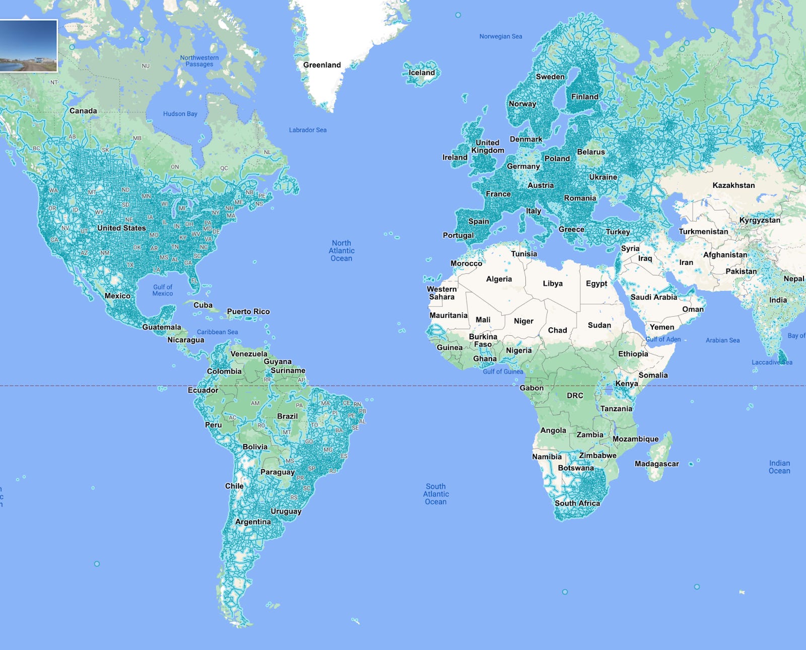
Beyond what’s in the scene, it’s also important to know what’s not there. The map below shows where Street View coverage is. You can see that Google hasn’t driven around most of Africa or the Middle East (Germany also has strangely spotty coverage). Plus, famously, China doesn’t let Google in, so definitely no Street View there.
Since discovering the videos, I’ve had some fun firing up Geoguessr myself to try my hand at geolocation. I’m okay at it, but I am not sure it’s more fun than watching someone find their location within meters in 10 seconds with no moving, panning, or zooming. Have fun. (NRB)
--
WITI x McKinsey:
An ongoing partnership where we highlight interesting McKinsey research, writing, and data.

The mainstreaming of additive manufacturing. Additive manufacturing (AM), also known as 3-D printing, is one of the most revolutionary technologies in manufacturing. It’s now a $14.7 billion industry, and it’s growing. But even while rapid innovation is driving its use, AM is still considered mostly a niche technology. A new article explores how manufacturers can take AM technologies to the next level.
Thanks for reading,
Noah (NRB) & Colin (CJN)
—
Why is this interesting? is a daily email from Noah Brier & Colin Nagy (and friends!) about interesting things. If you’ve enjoyed this edition, please consider forwarding it to a friend. If you’re reading it for the first time, consider subscribing (it’s free!).